

Nossos serviços estão apresentando instabilidade no momento. Algumas informações podem não estar disponíveis.
-
Home

-
Geosciences
-
Territorial organization
-
Territorial Organization
- NP-Novo Portal
Brazilian Semi-arid Region
Description
The Brazilian Semi-Arid Region is delimited by the Superintendence of Northeastern Development - SUDENE, considering the weather conditions that prevail in the semi-arid contexts, as the pluviometry. As a reflex of the weather conditions, the hydrography is frail, in various ways, being unable to support the larger rivers so that they can be perennial in the long drought periods, the exception being the São Francisco River. Due to its hydrologic characteristics, which allow for its subsistence throughout the year, the São Francisco River gains a special meaning to the populations living by the river and those of the Sertão area.
About the publication - 2014
Register of the Brazilian municipalities located in the semiarid Region of the country, with a total extension of 982,563,3 km². Considering that area, the Northeast Region concentrates about 89.5%, encompassing most of the northeastern states, except for Maranhão; and the State of Minas Gerais, located in the Southeast Region, holds the other 10.5% (103,589.96 km²). The Semiarid Region was defined according to the isohyet of 800 mm, the Aridity Index of Thorntwaite of 1941 (municipalities with an index of up to 0.50) and the Drought Index (above 60%).
The first delimitation of the Brazilian Semi-arid Region was established by the Law no. 7,827 of 09/27/1989. Brazilian Semi-arid was, therefore, a region encompassed in the operation area of SUDENE, with average annual rainfall equal to or lower than 800 nm. The redefinition of this subdivision was established by Resolution no. 10,929 of 07/30/1994, and updated by Decree no. 1,181 of 1995, both from the former SUDENE.
In 2005, there was an update in the Brazilian Semi-arid Region after the release of the Final Report, developed by the Inter-Ministry Work Group for the Redefinition of Semi-Arid Boundaries in the Northeast and in the Drought Polygon. The new subdivision had a total extension of 982,563.3 km2 and was formalized by Decree no. 89 of 03/16/2005, of the Ministry of National Integration. From this area, the Northeast Region holds 89%, encompassing most of the northeastern states, except for Maranhão; and Minas Gerais, located in the Southeast Region, holds the remaining 10.5% (103,589.96 km2). The previous subdivision was delimited according to the 800 mm isohyetal line; aridity index equal to or lower than 0.50, considering the period between 1961 and 1990; and drought risk above 60%.
More on the product - 2014
Databanks and tables
Maps
Documentation
Files in ODS format
Files in XLS format
Files in PDF format
Learn more - 2014
News and Releases
IBGE releases 2024 update of geographic divisions in Brazil
The IBGE makes available today (24) the 2024 update of 21 legal territorial and institutional divisions...
24/06/2025

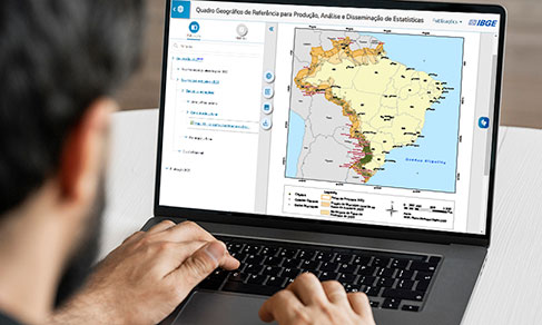
IBGE updates geographic divisions of reference to disseminate results of 2022 Census
The IBGE released today (19) the 2022 edition of the Geographic Reference Framework for the Production,...
19/07/2023
IBGE releases updating of legal territorial divisions of Brazil
The IBGE releases today (14) an updating of the legal territorial divisions of Brazil. Altogether, they...
14/07/2022
Links
SUDENE - www.sudene.gov.br
Legislação relacionada
- Decree no. 89 of 03/16/2005, of the Ministry of National Integration;
- Resolution no. 115 of 11/23/2017, which confirms the SUDENE Advisory Board decision to include the new Brazilian Semi-arid Region delimitation, making it official
FAQ
Is the IBGE responsible for Brazilian Semi-arid Region delimitation?
No. The Superintendence of Northeastern Development (SUDENE) is responsible for the Brazilian Semi-arid Region delimitation.
Why does the IBGE classifies the Brazilian Semi-arid Region as a geographic subdivision?
The IBGE aims to release geographic subdivisions that are relevant for statistical dissemination, planning and for public and private investment.
Which is the frequency of the Brazilian Semi-arid Region updating?
Brazilian Semi-arid Region, as a legal subdivision, will only have its delimitation updated when there is a legislative or normative update of these subdivisions. Existing updates related to the Territorial Division of Brazil might have an impact on the states and municipalities borders and nomenclature.
Where can I obtain more information about the Brazilian Semi-arid Region?
For more information on SUDENE, please visit the institution’s website (http://sudene.gov.br/delimitacao-do-semiarido).
Is the Brazilian Semi-arid Region the only operation area of SUDENE?
No. The operation area of SUDENE encompasses the states of Maranhão, Piauí, Ceará, Rio Grande do Norte, Paraíba, Pernambuco, Alagoas, Sergipe and Bahia; the region and municipalities of the state of Minas Gerais, which the Laws no. 1,348 of 02.10.1951, no. 6,218 of 07.07.1975, and no. 9,690 of 07.15.1998 are addressed to; the municipalities of Águas Formosas, Angelândia, Aricanduva, Arinos, Ataléia, Bertópolis, Campanário, Carlos Chagas, Catuji, Crisólita, Formoso, Franciscópolis, Frei Gaspar, Fronteira dos Vales, Itaipé, Itambacuri, Jenipapo de Minas, José Gonçalves de Minas, Ladainha, Leme do Prado, Machacalis, Monte Formoso, Nanuque, Novo Oriente de Minas, Ouro Verde de Minas, Pavão, Pescador, Ponto dos Volantes, Poté, Riachinho, Santa Fé de Minas, Santa Helena de Minas, São Romão, Serra dos Aimorés, Setubinha, Teófilo Otoni, Umburatiba and Veredinha, all in the state of Minas Gerais; and, also, the municipalities of Espírito Santo related to Law no. 9,690 of 07.15.1998, as well as the municipality of Governador Lindenberg.
Your question was not answered here?
Please contact us through our service channels.