

Nossos serviços estão apresentando instabilidade no momento. Algumas informações podem não estar disponíveis.
-
Home

-
Geosciences
-
Territorial organization
-
Regional division
- NP-Novo Portal
Metropolitan Geographies and Urban Clusters
Description
The registry of Brazilian municipalities located in Metropolitan Areas – RMs, Urban Agglomerations and Integrated Development Areas – RIDEs is updated by the Surveys of Metropolitan Areas, Urban Agglomerations and Integrated Development Areas. The main goal is to identify the political-administrative units in Brazil located in Metropolitan Areas, Urban Clusters and Integrated Development Areas, which deserve specific treatment on behalf of their planning and management peculiarities.
Technical Information
Technical Notes
01/2022 - Explanatory Note on the changes in the geocodification of Metropolitan Areas, Integrated Development Regions and Urban Agglomerations
About the publication - 2025
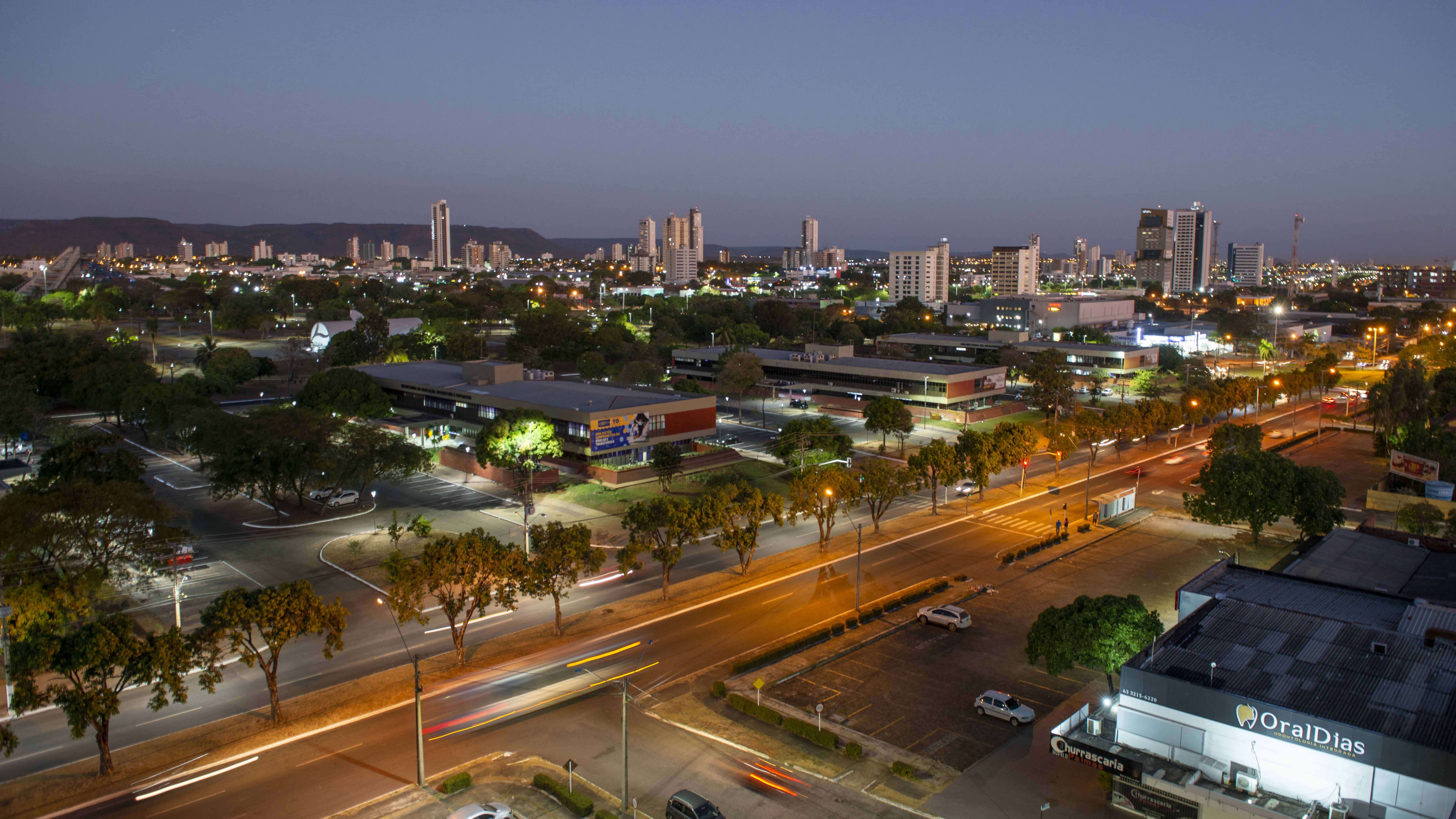
The current IBGE review shows changes in Tocantins and Amapá, with the inclusion of new municipalities in the Palmas Metropolitan Area (TO) and the creation of new Metropolitan Areas in the State of Amapá (AP).
In Tocantins, according to State Complementary Law No. 167/2025, of July 21, 2025, the Palmas Metropolitan Area (TO) was expanded to include the municipalities of Lizarda (TO), Chapada de Areia (TO), Lagoa do Tocantins (TO), Mateiros (TO), Monte Santo do Tocantins (TO), Novo Acordo (TO), Ponte Alta do Tocantins (TO), Rio Sono (TO), Santa Tereza do Tocantins (TO), Nova Rosalândia (TO), São Félix do Tocantins (TO), Rio dos Bois (TO), Lagoa da Confusão (TO), Divinópolis do Tocantins (TO), and Cristalândia (TO).
The State of Amapá, according to State Complementary Law No. 0178, of November 6, 2025, created the Metropolitan Areas of the Jari Valley (AP), the Lakes Region (AP), the North of the State (AP), the Amapari Valley (AP), the Araguari Valley (AP), and the East of the State (AP). These Metropolitan Areas are added to the Metropolitan Area of Macapá (AP), raising the number of Metropolitan Areas in Amapá to 7 and including all municipalities of the State in some Metropolitan Area.
There were no changes in the Brazilian Integrated Development Areas, Urban Clusters, or other Metropolitan Areas of the other Brazilian states. Currently, there are 83 Metropolitan Areas in the country, with the state with the largest number of Metropolitan Areas being Santa Catarina (14), followed by Paraíba (12) and São Paulo (9). Urban Clusters, on the other hand, are three in the state of São Paulo and two in the state of Rio Grande do Sul.
Metropolitan Areas and Urban Clusters are divisions established by state complementary law, in accordance with the determination of the 1988 Federal Constitution, aiming to integrate the organization, planning, and execution of public functions of common interest. The definition of Metropolitan Areas and Urban Clusters is the responsibility of the States, according to paragraph 3 of Article 25 of the Federal Constitution.
Integrated Development Areas (RIDEs), in turn, are defined as administrative regions that encompass different Federation Units. RIDEs are created by specific legislation, in which the municipalities that compose them are listed, in addition to defining the operational structure and the interests of the participating political-administrative units. In the case of RIDEs, the competence to create them belongs to the Union, according to paragraph 1 of article 43 of the Federal Constitution.
More on the product - 2025
Database and tables
Geoserviços
- Metropolitan Sub-Category categoria Metropolitana (cluster of municipalities) - 2025
- Urban Cluster (list of municipalities) - 2025
- Urban Cluster (cluster of municipalities) - 2025
- Coastal Municipalities (list of municipalities) - 2025
- Coastal Municipalities Costeiros (cluster of municipalities) - 2025
- SUFRAMA Operating Area (list of municipalities) - 2025
- Immediate Geographic Region (list of municipalities) - 2025
- Immediate Geographic Region (cluster of municipalities) - 2025
- Intermediate Gepgraphic Region (list of municipalities) - 2025
- Intermediate Geographic Region (cluster of municipalities) - 2025
Learn more - 2025
News and Releases
IBGE publishes updated Metropolitan Geographies and Urban Clusters
The Brazilian Institute of Geography and Statistics (IBGE) released, this Tuesday (16), the updated geographies...
16/06/2026
IBGE releases 2024 update of geographic divisions in Brazil
The IBGE makes available today (24) the 2024 update of 21 legal territorial and institutional divisions...
24/06/2025

IBGE releases updating of legal territorial divisions of Brazil
The IBGE releases today (14) an updating of the legal territorial divisions of Brazil. Altogether, they...
14/07/2022
Update of territorial subdivisions expands Metropolitan Area of Southwestern Maranhão
The IBGE releases today (20) an updated list of the municipalities that form Metropolitan Areas (RMs),...
20/05/2021
IBGE updates the list of municipalities that make up the Brazilian territorial divisions
The IBGE carried out another semiannual update of the list of municipalities that make up the Metropolitan...
17/11/2020
IBGE updates list of municipalities that form the Brazilian territorial subdivisions
The IBGE has released a new six-month update of the list of municipalities that compose the Metropolitan...
22/05/2020
IBGE updates the list of municipalities that integrate Brazilian territorial divisions
Based on information of June 30, 2019, the IBGE once again carried out the biannual update of the list...
06/11/2019
IBGE updates list of municipalities that integrate Brazilian territorial divisions (2)
The IBGE once again updated the list of municipalities comprising the Metropolitan Areas (RMs), Development...
15/05/2019
IBGE updates municipality list of the Brazilian territory sections
The IBGE carried out another update in the list of municipalities of the Mertopolitan Areas (RMs), integrated...
16/11/2018
Errata
Calendar error in release: “Geographic Framework of Reference for Production, Analysis and Dissemination of Statistics: Legal Regional Geographies”
Published date: 29/07/2024
Description:
Error characterized for not meeting the date scheduled for the release of the product, according to calendar made available on December 2023. The product was anticipated due to the readjustment of deadlines, due to the change in the scope of the release related to the geographies made available, which also led to the readjustment in the title of the product from "Geographic Framework of Reference for the Production, Analysis and Dissemination of Statistics: Legal Regional Geographies" to "Metropolitan Geographies and Urban Agglomerations, version 2023”.Therefore, the date scheduled for the release of the product "Metropolitan Geographies and Urban Agglomerations, version 2023" was anticipated from September to August 2024.
Actions: The release calendar has been changed.
Replacement of tables with the composition of Metropolitn Areas, Urban Agglomerations and Integrated Development Areas for years 2018, 2020, 2021 and 2022
Published date: 29/08/2023
Description:
Change in the composition tables of the Metropolitan Areas, Urban Agglomenrations and Integrated Development Areas for years 2018 (1st and 2nd halves), 2020 (1st and 2nd halves), 2021 and 2022, in .xlsx, .xls and .ods, as well as in the associate databases, in order to adequate the municipalities' names to the names already published in Territorial Division of Brazil - DTB of the respective years.Actions: Tables in xls and ods were amended and repalced in the IBGE website.
Replacement of the table with the composition of the RMs, RIDEs and Urban Aglomerations of 31/12/2016
Published date: 01/02/2018
Description: Modification of the table of composition of the RMs, RIDEs and Urban Agglomerations of 31/12/2016 (Composicao_RMs_RIDEs_AglomUrbanas_2016_12_31, xls and ods formats). In the geocode of the municipality of Dumont (SP) there was no check digit. The figure was corrected from ‘351460’ to ‘3514601’.
Actions: The xls and ods tables were replaced on the website.
FAQ
Is the IBGE responsible for the Metropolitan Areas, Urban Agglomerations and Integrated Development Areas delimitation?
No. The Metropolitan Areas and Urban Agglomerations consist of arrangements of bordering municipalities and are established by a complementary state law, in accordance with Article 25, paragraph 3 of the 1988 Federal Constitution, aiming to integrate the organization, planning and execution of public functions of general interest. In the list provided by the IBGE, there are also categories associated to these subdivisions: metropolitan belts, metropolitan arches (highways), metropolitan expansion areas, metropolitan subdivisions, and others. The Integrated Development Areas, in turn, are defined as administrative areas that include different Federation Units. These subdivisions are created by specific legislation, under which the Federation Units forming them are listed, and which definesthe operational structure and the interests of the political-administrative member-units. In the case of RIDEs, the jurisdiction to create them belongs to the Federal Government, in accordance with Article 21, subsection 9; Articles 43 and 48, subsection 4, of the Federal Constitution.
Why does the IBGE research and make available the Metropolitan Areas, Urban Agglomerations and Integrated Development Areas as geographic subdivisions?
The main goal is to identify the political-administrative units in Brazil located in Metropolitan Areas, Urban Agglomerations and Integrated Development Areas, which demand a specific approach on behalf of their planning and management peculiarities. Besides that, the identification of the municipalities that form those subdivisions is essential for the definition of subdivisions in the sample surveys.
What is the difference between Metropolitan Areas and Integrated Development Areas – RIDEs?
Metropolitan Areas consist of arrangements of bordering municipalities and are established by complementary state law, that is, they can only be formed by municipalities from the same State. RIDEs are defined as administrative areas that include municipalities from different States and, consequently, are created by specific legislation by the National Congress.
Which is the frequency of the Metropolitan Areas, Urban Agglomerations and Integrated Development Areas updating?
The results are released semiannually with a reference data from the previous semester.
Your question was not answered here?
Please contact us through our service channels.
Legislação relacionada
Constitution of the Federal Republic of Brazil of 1988
Law no. 13,089, of January 12, 2015
It establishes the Metropolis Statute, changes in Law no. 10,257, of July 10, and makes other provisions.