

Nossos serviços estão apresentando instabilidade no momento. Algumas informações podem não estar disponíveis.
Air Links
Description
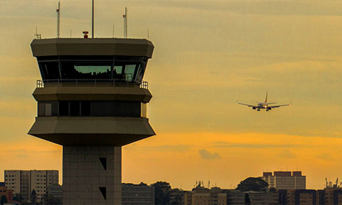
The study of Air Links identifies the flows of passenger and cargo air transportation, aiming at characterizing the location of Brazilian cities in the national urban system, taking this transportation mode as a base, and at evaluating its accessibility from the perspective of the financial costs and commuting time.
About the publication - 2010
The 2010 AirLinks publication identified 877 pairs of links between cities and analyzes the spatial distribution of trips, the number of passengers, the cargo volume and the cost of the air links. For this purpose, two databases were used: the first consists of administrative records of “origin-destination” links between 135 Brazilian cities with connecting airports, in 2010, provided by the National Civil Aviation Agency – ANAC; the second consists of information about cheaper and shorter links (not necessarily in the same flight), in October 2011, selected from the flight reservation online service of Decolar.com. The analysis of those flows is complemented by illustrative maps.
Main results - 2010
More on the product - 2010
2010 Airlinks
Publication
Applications
Databank and tables
Tables
The surveyed and analyzes data in the project Territorial Networks and Flows - Airlinks 2010 are available in spreadsheets, described below:
Cities databank: contains with information about the survey concerning urban centers taken individually;
Airlinks-passengers and Airlinks-cargo: contains information concerning airlinks between pairs of cities. The data were added by individual pair, regardless the direction, therefore, the fields indicating the origin and destination are merely arbitrary conventions. The year 2010, the most recent data and central focus of the study, presents a cohort of minimum values different from those of the time series;
Main flows: lists the most expensive airlinks between city-pairs. This matrix is not fully compatible with the previous one because there is no aggregation of city-pairs, the airlinks are one-way only. The outflow was considered in the computation of dominance. The links' order is:
- main link, encompassing the biggest flow departing from the origin;
- secondary link, encompassing the second biggest flow departing from the origin; and
- tertiary link, the third biggest flow from the origin.
Gravity model: presents the results of the application of the gravity model, as described in the publication. The distances between the cities were measured in a straight line based on Lambert Conformal Conic projection, central meridian 54º W; and
Cost matrix and Time matrix: contains the matrices of monetary cost and length of flights between the cities.
Shapefiles
The shapefiles of the project, in accordance with the maps presented in the publication, are available in zipped files, described below:
Passenger matrix and Cargo matrix: contain the vector files of the matrices of airlinks of passenger and cargo, from 1972 to 2010.
Flows: contain the vector files of the main, the secondary and the tertiary links of passengers and cargo. Each of the zipped files comes with the shapefile “aero_niveis_hierarq”, identifying the hierarchy of each city in the networks. In the corresponding dbf table, the column “NIV_PAX” concerns the hierarchy of the passenger transportation network and the column “NIV_CARGA”, the hierarchy of cargo. Number 1 stands for the top position in the hierarchy. The highest the number, the lowest the position of the city.
Cost and Time: contains the vector files concerning journey's average cost and time of the surveyed urban centers. The same shapefile set was used to generate the four maps under this sub-theme, according to the columns of the corresponding dbf: “CUSTO”, “TEMP_NUMER” (numerical version of the time format hh:mm:ss, where 1 corresponds to 24h), “CUSTO_LOG” (logarithmic scale version of cost normalized by distance) and “TEMPDIST” (time normalized by distance). The files denominated “sem_dados” comprise the municipalties that did not report the results for the date surveyed.
Gravitational model: contains the vector files of the results of the gravity model adjusted in the survey. The order of the variables of the dbf corresponding file is the same as the tabular data of the files.
Maps
- Map 1 - Passengers airlinks - 2010
- Map 2 - Cargo airlinks - 2010
- Map 3 - Passengers airlinks, by main flows - 2010
- Map 4 - Passengers airlinks, by secondary flows - 2010
- Map 5 - Passengers airlinks, by tertiary flows - 2010
- Map 6 - Cargo airlinks, by main flows - 2010
- Map 7 - Cargo airlinks, by secondary flows - 2010
- Map 8 - Cargo airlinks, by tertiary flows - 2010
- Map 9 - Passengers airlinks - 1972
- Map 10 - Passengers airlinks - 1975
- Map 11 - Passengers airlinks - 1980
- Map 12 - Passengers airlinks - 1985
- Map 13 - Passengers airlinks - 1990
- Map 14 - Passengers airlinks - 1995
- Map 15 - Passengers airlinks - 2000
- Map 16 - Passengers airlinks - 2005
- Map 17 - Cargo airlinks - 1972
- Map 18 - Cargo airlinks - 1975
- Map 19 - Cargo airlinks - 1980
- Map 20 - Cargo airlinks - 1985
- Map 21 - Cargo airlinks - 1990
- Map 22 - Cargo airlinks - 1995
- Map 23 - Cargo airlinks - 2000
- Map 24 - Cargo airlinks - 2005
- Map 25 - Residues of the gravity model of passengers - 2010
- Map 26 - Residues of the gravity model of cargo - 2010
- Map 27 - Average cost of travels, in R$, by airport - May 2012
- Map 28 - Cost normalized by distance, R$/km - May 2012
- Map 29 - Average journey time, in hours, by airport - May 2012
- Map 30 - Time normalized by distance, h/km - May 2012
Learn more - 2010
News and Releases
Study shows status of the aviation sector in Brazil and impacts of Covid-19
The impact of the Covid-19 panemic on the natioal aviation sector in 2020 led to the decrease of 53%...
10/12/2021
FAQ
What is the Air Links study?
The study Air Links identifies the air transportation flows of passenger and cargo, aiming at characterizing the location of Brazilian cities in the national urban system, taking this transportation mode as a basis, and at evaluating its accessibility from the perspective of financial costs and commuting time.
Your question was not answered here?
Please contact us through our service channels.