

Nossos serviços estão apresentando instabilidade no momento. Algumas informações podem não estar disponíveis.
-
Home

-
Geosciences
-
Maps
-
Brazil: Geographic networks
- NP-Novo Portal
Areas of Influence of Cities
Description
The survey Area of Influence of Cities - REGIC defines the hierarchy of the Brazilian urban centers and delimitates the areas of influence associated to them. It is in this survey that the Brazilian regional capitals and metropolises are identified as well as how far their spatial influence goes.
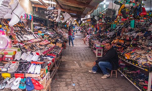
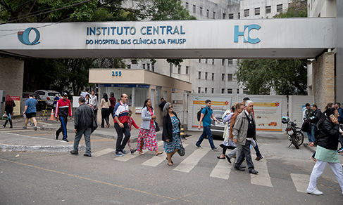
The identification of the urban hierarchy and influence areas is carried out by means of the classification of the urban centers that have certain equipment and services and that attract populations from other localities. The differentiated supply of goods and services among the cities makes populations move to well-equipped urban centers searching for health and education services or an airport, for instance. Tracing the relationships between the Brazilian cities based on the analysis of goods, services and management flows is an important tool for making choices concerning location, as the decision to where a university, a hospital or a comapany's branch should be.
About the publication - 2018 - Definitive results
The publication of the survey Areas of Influence of Cities 2018 updates the reference framework of the Brazilian urban network. This is the fifth edition of the survey that was previously published in 1972, 1987, 1993 and 2007. The 2018 edition maintained the theoretical-methodological contribution of the last edition, with procedural improvements and added other topics related to the urban network, such as the identification of flows between Brazilian cities bordering neighboring countries.
The Brazilian urban network, in the present study, is structured in two dimensions: the hierarchy of urban centers, divided into five main levels (Metropolises, Regional Capitals, Sub-Regional Centers, Zone Centers and Local Centers); and the areas of influence, identified by the connection between low ranked and high ranked the cities in the urban hierarchy. Hierarchies and connections between the Cities, as well as the delimitation of the areas of influence, were built based on specific survey of primary data, with the use of administrative records and with the input of other IBGE surveys relevant to the theme focused by this publication.
In addition to the publication itself, which contains the urban network and sectoral analyzes that help improve the qualification of the results, the survey database is available, and could be especially for studies that focus on other themes or other scale of areas than the national one.
Considering that the IBGE has been carrying out this survey for five decades, this publication contributes to the understanding of the historical evolution of the urban phenomenon in the country, especially of the relationships between urban centers. Previous versions of this study show that it can serve as an input for planning, especially for location decisions, whether for public services, business distribution or investments in the territory, taking into account the spatial relationships between urban centers and the different attractiveness that cities exert on population for the acquisition of goods and services.
More on the product - 2018 - Definitive results
Publications
Database
- REGIC 2018 - Population Arrangements - Tabular Database (xlsx | ods)
- REGIC 2018 - Cities - Tabular Database (xlsx | ods)
- REGIC 2018 - Connection between Cities - Tabular Database (xlsx | ods)
- REGIC 2018 - International - Cities - Tabular Database (xlsx | ods)
- REGIC 2018 - International - Connection between Cities - Tabular Database (xlsx | ods)
- REGIC 2018 - Vector Database
- REGIC 2018 - Agricultural flows - Tabular Database
- REGIC 2018 Link matrix - Tabular Database (xlsx | ods)
Documentation
- Methodological Note - Areas of Influence of Cities 2018
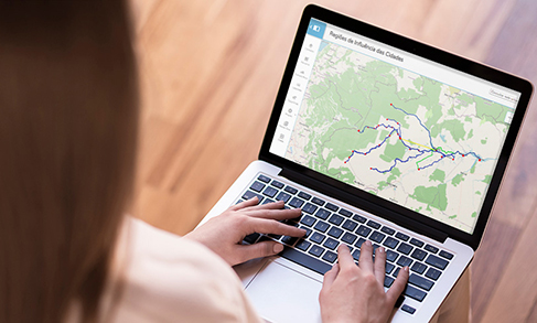
Interactive maps and search by Cities
Publications - 2018 - Definitive results
Regiões de influência das cidades : 2018 / IBGE, Coordenação de Geografia
Material type: Book
Year: 2020
Learn more - 2018 - Definitive results
News and Releases
IBGE surveys portray the Brazilian urban network for nearly six decades
The Brazilian Institute of Geography and Statistics releases this Monday the publication Regions of Influence...
16/12/2024

New module of the Interactive Geographic Platform calculates road, waterway and air distances between Brazilian municipalities
Starting today (Dec 6th), the IBGE will make available the reference base for road, waterway and air...
06/12/2022
IBGE launches interactive dashboard to help municipalities fight the pandemic
The IBGE launches today (21) the Covid-19 Dashboard by Municipality, with interactive maps that enable...
21/09/2020
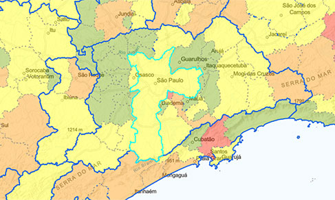
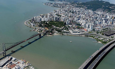
REGIC 2018: Campinas/SP, Florianópolis/SC and Vitória/ES are now among the 15 Metropolises of the Country
Campinas/SP, Florianópolis/SC and Vitória/ES are now counted among the current 15 Metropolises. With...
25/06/2020
Campinas, Florianópolis and Vitória are the New Brazilian Metropolises
Between 2008 and 2018, Brazil had three new metropolises and 32 cities made into regional capitals in...
25/06/2020
Survey shows how people used to move around to go shopping before the pandemic
The IBGE releases today (21) the survey Areas of Influence of Cities (Regic) 2018 – Information on Trade...
21/05/2020
To prevent the spread of Covid-19, IBGE anticipates data on population access to health care
The IBGE anticipated for the Ministry of Health and the Oswaldo Cruz Foundation (Fiocruz) information...
07/04/2020
Errata
Change in the description of two variables in the "REGIC 2018 - Cities" database and change of a record in the "REGIC 2018- Population Arrangements" database of the Areas of Influence of Cities 2018
Published date: 09/10/2020
Description:
The description of the "REGIC 2018 Cities" database had the description of two variables inverted: VAR02, City area, was incorrectly described as Gross Domestic Product (GDP), whereas VAR03, GDP, was described as City area. Therefore, the "description of variables" spreadsheet was amended.In the “REGIC 2018 – Population Arrangements” database, the municipality of Fortaleza de Minas (MG) was associated with the Population Arrangement of Passos/SP, when the correct name of the unit is Population Arrangement of Passos/MG. That record in the table was amended.
Actions: The REGIC 2018 - Cities and REGIC 2018 - Population Arrangements were amended and replaced in the download area of the databases of the REGIC 2018 survey.
Links
FAQ
Does the survey REGIC define metropolitan areas?
The REGIC survey does not define metropolitan areas. In Brazil, the official metropolitan areas are established by a complementary state law.
On the other hand, REGIC identifies the Metropolises, which are considered the highest hierarchical level of the urban network. The concept of Metropolis at the REGIC refers to cities with a big population, which provide a great variety of services, a position of command in comparison with other cities – for the fact of housing companies and public institutions – and that attract populations from subordinate cities in search of goods and services. The Metropolises at the REGIC survey are presented with their area of influence, which are usually much bigger than a metropolitan area.
What is the periodicity of REGIC?
REGIC is conducted every 10 years. In the intervals, other thematic surveys in the segment of Networks and Geographic Flows take place, thus enabling a partial view of the changes in the urban networks between the releases of REGIC editions. Some examples are the studies entitled Air Links, Road and Waterway Links and the survey Territory Management.
What are ACPs?
Areas of Population Concentration.