

Nossos serviços estão apresentando instabilidade no momento. Algumas informações podem não estar disponíveis.
-
Home

-
Geosciences
-
Maps
-
Brazil: Geographic networks
- NP-Urban Regional Division
Urban Regional Division | 2013
Description
The Urban Regional Division is a contribution from the IBGE to the Brazilian territorial dynamics analysis; it provides a regional perspective of Brazil considering articulate flows of its urban network. The identification and delimitation of new regional designs, called herein Urban Articulate Regions, is strongly linked to the comprehension of socio-spatial changes that occur in the country, and it is also linked to the way how these changes are understood. All the identified Major Regions are based on one leading city from which the relationships between agents and enterprises in their respective territories are established.
About the publication - 2013
Based on the conceptual-methodological framework developed in the Areas of Influence of Cities Project - REGIC 2007, the Regional Urban Division 2013 constitutes a territorial division in three different scalar levels that covers the entire national territory. In this division, each region created is contiguous and each municipality belongs to a single territorial unit. An inherent specificity of the work is the identification of a main municipality for each region.
In this sense, the operational challenge faced by the present work is related to the need to reconcile the discontinuous processes present at the geographic space, represented by the dynamics of the material and immaterial flows that go through it and the necessary adjustments to delimit territorially contiguous regional units, although subject to multidirectional bindings.
The identification and delimitation of the new regional shapes, here called Urban Articulation Regions, are strongly linked to the understanding of the socio-spatial transformations that occur in the country and also to the way in which these transformations are absorbed.
The new territorial framework, thus, appears with significant changes in the criteria of regional determination - regional sets where some distinguishing and striking aspects of the territory were prioritized in order to set the borders of each regional space. The regions were contextualized in the light of the combination between the urbanization and the national market integration processes, with the emergence of vertical structures that establish network relations and strengthen cities, towns and urban agglomerations as fundamental elements for the interconnection of management, infrastructure and productive activities.
More on the product - 2013
Applications
- Map Portal - This application provides the visualization of a number of maps produced by the IBGE, as well as handling spatial data made available.
Database and tables
- Composition of the areas - XLS | ODS
- Formation stages - XLS | ODS
- Extended Areas of Urban Connectivity
- Intermediate Areas of Urban Connectivity
- Immediate Areas of Urban Connectivity
Maps
- Urban Regional Division
- Extended Areas of Urban Connectivity
- Intermediate Areas of Urban Connectivity
- Immediate Areas of Urban Connectivity
Technical notes
Access hereLearn more - 2013
News and Releases
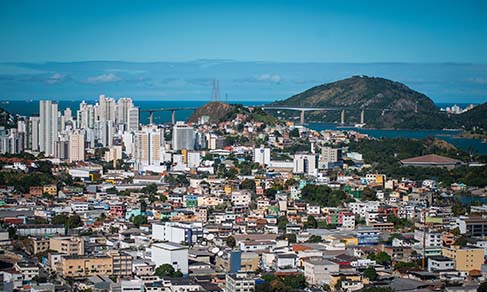
Classification of Vitória as a metropolis reduces relevance of Rio de Janeiro in the Southeast Region
One of the three new metropolises in Brazil , according to Areas of Influence of Cities (Regic 2018),...
15/12/2021
Errata
Calendar error in the release of Urban-Regional Division of Brazil 2nd edition
Published date: 22/10/2021
Description:
The IBGE has postponed the release of the Urban-Regional Division of Brazil 2nd edition. Due to the need to adjust the dissemination deadline, the release of the product was altered from November to December of 2021.Actions: The release calendar has been changed.
Calendar error in the Urban Regional Division: Areas of urban regional connectivity 2020
Published date: 01/06/2021
Description:
The IBGE has postponed the release of Urban Regional Division: areas of urban regional connectivity 2020. Due to the need of rearranging production and dissemination dates, the release of this product has been rescheduled from October to November 2021.Action: The release calendar was changed.
Replacement of the Regional Urban Division database
Published date: 29/10/2018
Description:
It was necessry to change the files on the Regional-Urban Division database, available on the IBGE website. The Federation Unit of Piauí, where the Nazária municipality is located, was listed under code no. 26, instead of the right code, 22.Action: The database was corrected and replaced on the IBGE website.
FAQ
What is an Urban Regional Division?
An Urban Regional Division is a teritorial division in three different levels, covering the whole national territory. In such a division, each created region is contiguous and each muncipality belongs to a single territorial unit. A particularity of this method is the identification of a main municipality for each region. As its base is the urban network, its limits do not necessarily coincide with the sate borders. The identification and delimitation of the new regional shapes, here called Areas of Urban Connectivity, are strongly linked to the understanding of the socio-spatial transformations that occur in the country and also to the way in which these transformations are absorbed.
What are Areas of Urban Connectivity?
The current study identified areas under three reference scales, denominated Extended Areas of Urban Connectivity, Intermediate Areas of Urban Connectivity and Immediate Areas of Urban Connectivity. The Areas of Urban Connectivity are spaces organized in networks, where the territorial management centers and the flows determine the regional connectivities and arrangements. However, these characteristics only reflect historical processes that were formed by the interaction between various actors and contexts, such as: the ecological domains; the population; agricultural and industrial activities; transportation and tertiary activities, and which, although underlying this analysis, provide an overview of the country's diversity.
How often are the studies Population Arrangments and Brazilian Urban Concentration updated ?
The study is updated every ten years after the last Regions of Influence of Cities - REGIC, from which the data are taken to compose one of the delimitation criteria. It is at the IBGE's discretion, due to necessity or convenience, to make adjustments to the product update cycles.
Your question was not answered here?
Please contact us through our service channels.