

Nossos serviços estão apresentando instabilidade no momento. Algumas informações podem não estar disponíveis.
-
Home

-
Geosciences
-
Maps
-
Brazil: Geographic networks
- NP-Novo Portal
Urbanized Areas
Description
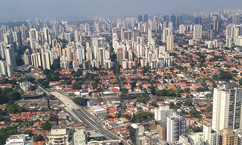
The urbanized areas of Brazil result from the mapping of the urban sprawl in Brazilian cities with the objective of monitoring the process of urbanization of the territory. The mapping of urban sprawl based on the use of satellite images creates a vector layer that delimitates the constructed areas in Brazilian cities. That is a growing demand from society and from the government in an attempt to understand the history of expansion of cities and the geographic dynamics now in progress in the Brazilian territory. The current mapping provides input for the classification and ordering of land, thus contributing to create a national view of issues related to the urban space.
About the publication - 2019
A serious concern and the follow-up of the urban phenomenon are key elements to understand the society and the Brazilian territory over time. Among several forms of approaching the urban theme and the resulting spatial patterns, monitoring urbanized areas is one of the most important, since it reveals how much of the landscape remains or is transformed into patterns that highlight the lived space expressed in typical spatial forms of the urban phenomenon, developed under the criteria of building and distribution that allow daily neighborhood relations and that the relationship of people living there characterizes such a way of life.
With the release of this edition of the mapping of urbanized areas, reference year of 2019, the IBGE introduces significant methodological and editorial changes for the dissemination of such results in relation to the previous one, related to 2015.
Concerning the methodological changes, those resulting from the availability of images from the Sentinel-2/MSI satellite stand out, with a spatial resolution of 10 m as basic input for the same year in the entire country, as well as the inclusion of areas of empty allotments, though not considered urbanized areas in the current conception, since they do not have the elements of occupation, neighborhood and circulation required to configure an urban way of life, they represent an anthropic intervention that points to a growth trend of the urban form, important to be monitored in the long term.
In editorial terms, some improvements aimed at the appeal of the product, whose release is now made in two parts: the first one corresponds to a newsletter, also available in printed media, showing analytical commentaries about the major results of the reference year, illustrated with cartograms, tables and graphs, whereas the second part, published apart and only accessible in digital media, brings technical notes that provide a comprehensive methodological scenario of the study, with information about the major operational procedures adopted.
It should be highlighted that the complete results of this mapping remain in line with the so-called “urban agenda”, which is a whole set of concerns and demands for planning headed by the United Nations and that guided the previous edition as well. They are available on the IBGE Portal, on the page of the Urbanized Areas study, as well as on the Interactive Geographic Platform (PGI), also accessible in this channel. The geospatial database of this mapping, in vector format, can also be consulted in association with the other themes of the Environmental Information Database (BDiA). It is also possible to build tables for different geographic divisions on the IBGE System of Automatic Recovery (Sidra), according to the perspective of interest of users.
Information about the previous edition, whose comparability with the current data requires specific procedures and caveats, can be obtained in the Urbanized areas of Brazil 2015 publication, released in the Methodological Reports Series, also available on the portal, which encompasses the complete results of all editions of the mapping since 2005.
Main results - 2019
#seriehistorica2022103103828505
More on the product - 2019
Publication
Applications
- Urbanized Areas (Interactive Geographic Platform)
- Maps Portal
Databases and tables
- Comparison areas 2015/2019 (xlsx file)
- Areas by territorial division 2019 (xlsx file)
- Urbanized areas 2019 - Brazil (shapefile)
- Urbanized areas 2019 - Comparison (qml file)
- Urbanized areas 2019 (qml file)
SIDRA - IBGE System of Automatic Recovery
Maps
- Urbanized Areas 2019 - Brazil (pdf file)
Publications - 2019
Áreas urbanizadas do Brasil : 2019 / IBGE, Coordenação de Meio Ambiente
Material type: Book
Year: 2022
Learn more - 2019
News and Releases
Southeast concentrates more than one third of urbanized areas in Brazil
In 2019, Brazil had 45,945 km2 of urbanized areas, the equivalent to 0.54% of the Brazilian area. More...
23/11/2022
Errata
Calendar error in release: Brazilian Urbanized Areas
Published date: 31/07/2025
Description:
Error characterized for not meeting the scheduled release date of the product, according to calendar released in December 2024. The product has been postponed due to the need to readjust the deadlines during the steps of its production. Therefore, the release of the product "Brazilian Urbanized Areas" has been changed from 2025 to 2026.Actions: The release calendar has been changed.
Replacement in the Map of Urbanized Areas 2015
Published date: 02/07/2019
Description:
Replacement of Map 13 - Urbanized areas of Urban Concentrations of "Piracicaba/SP", "Campinas/SP", "Americana - Santa Bárbara d'Oeste/SP" and "Jundiaí/SP", SP due to an inversion in the toponym of a dam called Represa do Salto Grande.Actions: The document was corrected and replaced on the IBGE website.
Replacement of the Complete Publication in PDF format of the Urbanized Areas 2015
Published date: 02/02/2018
Description: Modification of legends in pictures 1, 2, 3, 4, 5, 6, 7, 8 and 9 of 'Elaborated by the Geography Department of the IBGE based on an image captured from Google Earth in 2017' into 'Elaborated by the Geography Department of the IBGE based on an RapidEye images for the period 2011 - 2014'.
Actions: The file was amended and replaced on the portal.
Substituição da base de dados das Áreas Urbanizadas 2015 (2)
Published date: 01/02/2018
Description: Modification in the nomenclature of Table 1 (formats .ots, .xls and .xlsx), in the momenclature of the shapefile and in the file 'LEIA-ME' (.txt). Modification in the title of Mapa00_AreasUrbanizadas2015_Brasil.pdf and in Mapa01_BoaVista_Macapa_Belem_Manaus_RioBranco_PortoVelho. Standardization of map resolution.PDF. Modification in Table 1 in the values of urbanized areas
FAQ
What are Urbanized Areas?
The Brazilian Urbanized Areas result from the mapping of the urban spots of the Brazilian cities and aims at monitoring the urbanization steps in the Brazilian territory.
Which are the differences between the 2005 and 2015 mapping?
The differences regard methodologies and inputs, besides the different set of municipalities involved. The 2005 Urbanized Areas, for example, were based on the CBERS-2B satellite images scaled 1:100,000, while the 2015 Urbanized Areas were based on RapidEye satellite images with spatial resolution of 5 meters on a sacle of 1:50,000 or less.
What period do the images cover?
The images used as basis for the 2005 Urbanized Areas mapping cover the years 2005 and 2007. Regarding the 2015 Urbanized Areas, the satellite images cover the period from 2011 to 2014.
Your question was not answered here?
Please contact us through our service channels.