

Nossos serviços estão apresentando instabilidade no momento. Algumas informações podem não estar disponíveis.
-
Home

-
Geosciences
-
Atlas
-
National
- NP-Milton Santos National Atlas of Brazil
Milton Santos National Atlas of Brazil
Description
The National Atlas of Brazil is a collection of maps and geographic analyses aimed at interested citizens. It describes, in details, the natural, economic and social conditions of Brazil with maps in a logical and balanced structure and with relatively uniform cartographic features in defined scales. As one of most important symbols of geographers’ work, the Atlas is both a historic and a geographic document.
The first publication was released by the IBGE in 1959, and it was called Atlas of Brazil. In 1966, a new edition named National Atlas of Brazil presented updated data on some of its pages. The National Atlas of Brazil 2010 version incorporated the name of the geographer Milton Santos to its own title in accordance with Law no. 11.159 of August 2th, 2005. In 2016, the IBGE first made available the digital version of the Atlas with annual updates.
About the publication - 2018 Digital National Atlas of Brazil
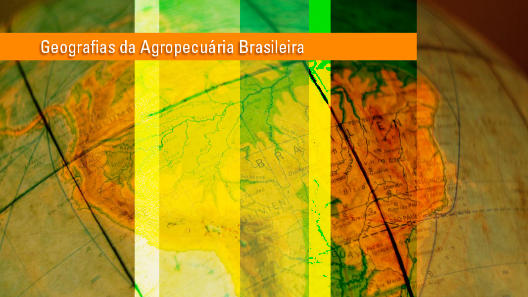
In the 2018 update, 26 boards have been used with themes that include inter-regional migration, sanitation, forestry and Municipal Gross Domestic Product, among others. To disseminate this product, the IBGE used the Interactive Geographic Platform - PGI, which makes it possible to visualize and analyse the Atlas' themes in PDF documents and in the Geoservice format. Users will also be able to download maps in shapefile format. The 2018 edition also has the thematic notebook Geographies of Brazilian Agriculture - A Territorial View of the Preliminary Results of the 2017 Census of Agriculture. With maps, graphs and explanatory texts on the topics researched in the 2006 and 2017 Census of Agriculture, the product addresses the spatial dynamics of the Brazilian agriculture, seeking to understand the processes of reorganization of the country's space. The content consists of 52 boards, 151 maps and 135 graphs with the main preliminary results of the Census of Agriculture released in July.
More on the product - 2018 Digital National Atlas of Brazil
National Digital Atlas of Brazil
Click here to access the National Digital Atlas of Brazil
Access hereLearn more - 2018 Digital National Atlas of Brazil
O Atlas Nacional Milton Santos é organizado em torno de quatro grandes questões:
O eixo temático “O Brasil no mundo” aborda questões como a desigualdade social, o acesso a informações, redes geográficas e fontes energéticas.
A relação entre “Território e meio ambiente” ressalta as diversas divisões do território brasileiro e traz mapas de relevo, clima, solos, recursos hídricos, vegetação, fauna ameaçada, além de informações sobre riscos ambientais.
O tema “Sociedade e economia” aborda a dinâmica geográfica, a urbanização, a desigualdade social, saúde, educação, saneamento, cidadania e espaço econômico.
O eixo das “Redes geográficas” considera os sistemas e as redes – geodésicas, cartográficas, viárias, aéreas, comunicação e energia – como componentes da logística territorial e, portanto, da localização geográfica das atividades econômicas no Brasil.
A Atualização do Atlas Nacional Digital do Brasil 2019 traz novas versões para mapas contidos nas seções "Sociedade e economia" e “Redes Geográficas”. A Atualização do Atlas Nacional Digital do Brasil 2019 é uma aplicação de análise geográfica, voltada para usuários que desejam ter acesso somente ao conjunto de mapas e também para os que possuem um conhecimento mais avançado na busca de informações geográficas online.
Na aplicação é possível acessar todas as páginas do Atlas, fazer download e consultar os dados geográficos, estatísticos e os metadados (informações sobre o dado). O usuário também pode navegar pelos mapas, alterar a escala de visualização, ver e exportar tabelas e arquivos gráficos, personalizar o mapa superpondo temas de várias fontes, gerar imagens, salvar o ambiente de estudo para posterior análise e abrir um ambiente personalizado de estudo.
Ao usuário é permitido ter acesso a todas as páginas da publicação podendo fazer download dessas páginas e consultar, para um melhor entendimento, os seus metadados. Já ao usuário mais avançado, a aplicação permite analisar o mapa em um ambiente interativo.
Para cada tema do Atlas é oferecido o metadado associado. Todos os temas encontram-se como geosserviços e podem ser exportados em outros formatos. A aplicação oferece a visualização temporal de alguns temas permitindo analisar as mudanças ao longo dos anos.
News and Releases
IBGE releases 2019 version of the Digital National Atlas of Brazil
The IBGE released today (May 29) the updated version of the Digital National Atlas of Brazil, including...
29/05/2019

IBGE releases geographic analysis of preliminary results of 2017 Census of Agriculture
The IBGE releases on Wednesday, December 19, a set of 52 boards in the Interactive Geographic Platform,...
19/12/2018
IBGE releases thematic maps of Census of Agriculture in digital platform
The IBGE released today, December 19, the thematic booklet Geographies of the Brazilian Agriculture -...
19/12/2018
Links
Saiba mais
National Atlas of Brazil - a short introduction
Diogo de Carvalho Cabral, translated into English by Joanna Konder (intern), supervised by Gisele Manhães
As one of the greatest symbols of a geographer's work, an Atlas is a document as much historic as it is geographic itself. Both natures appear not only “internally”, in the document design, but also “externally”, in the document relationship with the world and its temporality.
In this sense, it can be stated that since its emergence, in the 16th century, the Atlas was classified as an instrument for the reading of human history. Regarded as the first modern Atlas, published in 1570 by the Brabantian geographer Abraham Ortelius, the Theatrum Orbis Terrarum (“Theater of the Orb of the World”) was entirely “dedicated to the understanding of history”.
Indeed, in the Atlas’ introductory paragraphs, Ortelius enlightens: All [lovers of histories] will readily affirm with us how necessary is the knowledge of regions and provinces, of the the seas, the locations of mountains, valleys, cities, the course of the rivers, etc., for attaining a [full] understanding of the histories. This is is what the Greeks called by the proper name “geography” and certain learned persons (rightly) call the eye of history”.¹
Regarding the “external” sense, however, even when the purpose is the exclusive representation of the present moment, an Atlas becomes “historical” as the time gap gets bigger between the user and the portrayed reality; in other words, aging – at the expense of its geographic accuracy, particularly regarding the “anthropogeographic” aspects – enhances its value as a document of the past.
In this context, the digital collection of the six editions of the National Atlas of Brazil developed by the Brazilian Institute of Geography and Statistics, from the second half of the 20th century to the beginning of the 21th century, aims at facilitating the access to a rich historical geographic documentation about the evolution of the Brazilian territory.
As already said, this publication has six digital editions, the first one released in 1959 (Atlas of Brazil – General and Regional) and the last one in 2010 (Milton Santos National Atlas of Brazil). Gathered, these documents reveal the evolution of geographic knowledge and methodologies to represent the territory, as well as the changes in the territory's shape and content throughout the end of the 20th century and the beginning of the 21th century.
In the 1959 Atlas, designed according the old dichotomy Regional Geography/General Geography, Brazil is represented, in the first part, as a set of regions, while the second part introduces a scaled overview of the national territory.
The region was represented as a “geographic generalization”, showing the influence of the American geographer Richard Hartshorne, exposed in its work The Nature of Geography, whose first edition was released in 1939². According to Speridião Faissol, the region “represents to the Historian a set of integrated facts, which composes a concept based on a selective criterion”.³
Brazil was divided in six major regions: North (the present states of Amazonas, Pará, Acre, Roraima, part of Rondônia, part of Mato Grosso and part of Maranhão), Mid-North (the present state of Piauí, part of Maranhão and part of Ceará), Northeast (the present states of Rio Grande do Norte, Paraíba, Pernambuco, Alagoas, Sergipe and part of Bahia), East (the present states of Espírito Santo, Rio de Janeiro, part of Minas Gerais and part of São Paulo), South (Paraná, Santa Catarina, Rio de Janeiro, Rio Grande do Sul and part of São Paulo) and Central-West (the present states of Goiás, Mato Grosso do Sul, Tocantins, part of Mato Grosso and part of Maranhão).
Following the traditional geographic themes, each region was analyzed in terms of relief, climate, vegetation, population distribution (rural and urban), economic activities and transportation system.
In the Atlas’ second part, the same themes are surveyed covering the set of the national territory. Moreover, there is a comparison between the years 1900 and 1950, including the survey of internal migration in the 1940s. The national “value of production” - which is now named Gross Domestic Product (GDP) – and its many features (agricultural, mineral and industrial), besides the foreign market, are also geographically surveyed. And, finally, the potential of power plants is approached.
This Atlas represents the Brazilian territory in the beginning of the urbanization and industrialization process, when São Paulo was the only Federal Unit with urban population as its majority.
In conjunction with Rio de Janeiro, the south of Espírito Santo and the southernmost half of Minas Gerais, São Paulo constituted what Ruth Lopes Magnanini called “metropolitan block”.4 Not coincidentally, the latter was the main target state for national migrants, notably due to its economic expansion based on industries (mostly in textile, food and beverage sectors) and associated tertiary sector; between the periods of 1940 and 1950, São Paulo received more than a million migrants, coming, mainly, from Minas Gerais and Bahia.
Indeed, the East and the Northeast were the regions with the highest losses in population in this period, which can be explained to a large extent by the damage to the natural environment in some of the regional economies: deforestation and erosion in the soil used in coffee farming in the Zona da Mata and the south of Espírito Santo, scarcity of mineral deposits in the western plateau and Chapada da Diamantina and difficulties to access water resources in Serra Geral, Bahia and in the Drought Polygon, in general.
The expansion of the road network favors the spatial mobility of the population. Developed in 1951, the National Road Plan had been making the territory “flow” more easily with its investments. In the Northeast Region, for example, the Transnordestina or Fortaleza-Salvador highway ended up having a key role in the population outflow to the south, as, in the municipality of Feira de Santana (BA), it was connected with the Rio-Salvador highway.
The 2010 National Atlas reflects a rather different moment to the geographic method of territorial survey. The main concept is not the region anymore, but the territory and its use. In this context, as a shaping force of the earth’s surface, the human action creates places, and, so, organizes the society and the biophysical world.
Although maintaining certain themes and traditional representations (relief, climate, population distribution, etc.), the new approach is, at the same time, more detailed and more inclusive, seeking to represent the territorial distribution of the Brazilian population as an interface of two major dimensions: the local-spatial and ecological aspects.
This Atlas is divided in four major sections. In the first one, “Brazil in the world”, the country is presented in the globe in thematic world maps. Besides traditional representations of relief (physical map) and national authorities (political map), there are socio-environmental themes of huge importance in the contemporaneity, as the availability of water resources and the emission of carbon dioxide.
In the section “Territory and Environment”, the Brazilian territory is analyzed as an environmental reality – including the anthropogenic dynamism, especially in the subsection “Natural Resources and environmental issues” and “Environmental threats” - and as an institutional spatiality, which means it is composed by political-administrative mashes. The section “Population and Economy” surveys how Brazilian population and socio-economy are divided and make use of the national space and its resources, including the dynamic aspect, approaching themes like migration, foreign immigration and the evolution of the age pyramid, and others.
And finally, the section “Geographic networks” approaches classic themes like the hierarchy of cities and the territorial logistic, besides the theme whose importance boosted in the end of 20th century, the informational infrastructure.
The territory represented is also rather different from that of half century ago, although one might argue that certain changes were more quantitative than qualitative. The most evident example is the urban-industrial concentration in São Paulo and surrounding areas, an evident process in the end of 1980s and reinforced in the next period. (Milton Santos, still in the 1980s, proposed the concept of “Concentrated Region” to describe this territorial arrangement.)
“The industrialization resulted in a high wealth concentration in a large metropolitan territory set around São Paulo”, says Cláudio Egler (2010) “and spread over Campinas, São José dos Campos and Baixada Santista, setting up an actual global city-region that holds the power of decision-making towards finances and investment at national and South-American levels”.5 Even a certain decentralization process that affected the national industry, at the turn of the 21th century, showed “concentration”: there is a trend of industry and associated services moving into areas in countryside of the São Paulo state and southern Minas Gerais.
In a similar way, the new industrial areas, as in the sectors of motor vehicles and shipbuilding, favored places with dense population and with efficient transportation systems and other factors – generally, metropolitan areas as Porto Alegre, Curitiba and Belo Horizonte. The intermediate good industry, however, led by the sources of raw material, have been taken to the North and Northeast Regions, as in the case of the processing of ferrous metals.
Capital intensive, those mining and quarrying industries brought social and environmental changes. An important example is the manufacturing of pig iron for exportation in the railway Carajás-Itaqui, between Pará and Maranhão, fed by charcoals which used wood from native forests, under precarious working conditions.
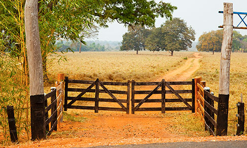
Deforestation and environmental degradation are also processes related to the expansion of agribusiness for food purposes of the meat-grain chain, which advanced, mainly, in the Central-West region. Both the technical standards and the large-production scale led to a high use of pesticide, affecting deeply the regional ecosystems including the abundant aquifers in the Cerrado biome.6
Those situations are represented, among other places, in maps related to the sources of threats to terrestrial and fluvial biodiversity, moreover in those that show the distribution of endangered species (birds, mammals, reptiles, amphibians, insects and aquatic invertebrates and fish, pages 90-96, 107-109). Despite the loss of pace since 1990, the Zero Deforestation of Amazon was and still is one of the biggest challenges in Brazil.
In summary, the National Atlas of Brazil allows the reader to learn and reflect about the historic trajectory of the Brazilian territory, as well the evolution of the geographic method of analysis and representation.
1 - Quoted by Walter Goffart, Historical Atlases: The First Three Hundred Years, 1570-1870. Chicago: The University of Chicago Press, 2003, p. 1.
2 - Richard Hartshorne, The nature of geography: a critical survey of current thought in the light of the past. Ann Harbor: The Association of American Geographers, 1939.
3 - Speridião Faissol, “Divisão regional do Brasil”, in Conselho Nacional de Geografia, Atlas do Brasil (Geral e Regional). Rio de Janeiro: IBGE, 1959, p. 9.
4 - Ruth Lopes Magnanini, “População urbana do Brasil em 1950”, in Atlas do Brasil.
5 - Cláudio Antônio G. Egler, “O espaço geoeconômico”, in Instituto Brasileiro de Geografia e Estatística, Atlas Nacional do Brasil Milton Santos. Rio de Janeiro: IBGE, 2010, p. 200.
6 - Idem, p. 201.