

Nossos serviços estão apresentando instabilidade no momento. Algumas informações podem não estar disponíveis.
-
Home

-
Geosciences
-
Maps
-
Brazil: Reference maps
- NP-Political Maps
Political Maps
About the publication - 2016 Political Map – 1:5 000 000
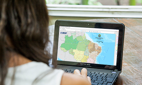
Maps containing information on the political-administrative division distributed along its 26 states and the Federal District, and also the headquarters of the municipalities compatible with the scale. Produced from the continuous cartographic base of Brazil, on a 1:1 000 000 scale, it is a reference for the design of other maps in several IBGE publications, such as the Geographic School Atlas, the Atlas of the 2010 Population Census, the Brazilian Statistical Yearbook and Brazil in Figures, among others. The IBGE has produced the Political Map of Brazil since 1940. Its first edition was on a 1:6 500 000 scale, but from 1950 on this scale was standardized at 1:5 000 000.
More on the product - 2016 Political Map – 1:5 000 000
Learn more - 2016 Political Map – 1:5 000 000
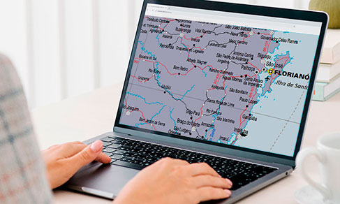
The Political Map of Brazil in the 1:5,000,000 scale comprises a cartographic representation of the entire Brazilian territory.
This base of territorial reference supports decision makers in the actions needed to the macro-planning of Brazil. Students and education professionals, at every level, are also potential users of this product.
The Map is based on the Continuous Cartographic Base of Brazil to the Millionth - BCIM. It shows the political-administrative organization of the national territory through its 26 states and the Federal District, as well as the headquarters of the municipalities compatible with this scale.
It brings a table listing the Federation Units, their respective capitals, resident population, territorial area, total number of municipalities and population density, as well as groups the FUs according to the Brazilian Major Regions. The product is available in the printed and digital versions.
The cartographic information portrayed in the Political Map of Brazil in the 1:5,000,000 scale is classified according to the following categories:
- Hydrography - water bodies and islands;
- Transportation system - roads, railways, gas pipelines, ports and airports;
- Localities - classified according to the population. Only the most populated localities are portrayed in the regions where it is not possible to represent all the localities in this scale;
- Borders - International (for information only), state and district, and nautical lines;
- Energy and communications - plants;
- Reference points - extreme points;
- Relief - mounts and peaks;
- Toponymy - According to the criteria established by the IBGE´s Reference Center on Geographical Names - CRNG.
The criteria adopted for toponymy of rivers outside Brazil and capitals of South American countries follow the cartographic publication recommended by the United Nations Group of Experts on Geographical Names - UNGEGN.
Endonyms (1) were used for the capitals of the South American countries, also according to the International Map to the Millionth Scale - CIM. Exonyms (2) were assumed to be traditional in our culture. The following simplified definitions were considered:
- endonyms - Foreign geographical names that, once written in international publications, follow the official language of the country of origin.
- exonyms - Foreign geographical names written differently from the official language of the country of origin.
Previous versions: 2004 / 2013 / 2015
News and Releases
IBGE releases new edition of Political Map of Brazil
The IBGE releases today (28) the 2021 version of the Political Map of Brazil in the 1:2,500,000 scale,...
28/11/2022
IBGE launches new edition of Political Map of Brazil
The IBGE released today (26) the new edition of the Political Map of Brazil, version 2021, in the 1:5,000,000...
26/09/2022
Errata
Calendar error in release: “Political Map of Brazil, scale 1:2,500,000, version 2023”
Published date: 30/04/2024
Description:
Error characterized for not meeting the release date of the product, according to calendar released in December 2023. The product has been postponed due to the need to re-process the data due to inconsistencies found in the step of consolidation of the basic input.Therefore, the release of the 2023 version of the product "Political Map of Brazil, scale 1:2,500,000" was transferred from May to June 2024.
Actions: The release calendar has been changed.
Calendar error in release: "Political Map of Brazil, scale 1:5,000,000, version 2023"
Published date: 30/04/2024
Description:
Error characterized for not meeting the release date of the product, according to calendar released in December 2023. The product has been postponed due to the need to re-process the data due to inconsistencies found in the step of consolidation of the basic input.Therefore, the release of the 2023 version of the product "Political Map of Brazil, scale 1:5,000,000" was transferred from May to June 2024.
Actions: The release calendar has been changed.
Calendar error in the release of the Political Map of Brazil at the 1:2,500,000 scale - 2021 edition
Published date: 05/07/2021
Description:
Error characterized by the non-compliance with the release date of this product set in the calendar made available in December 2020. The product was cancelled due to the prolonging of the pandemic in 2021, which eventually led to production restraints and rescheduling. As a result, the release of the Political Map of Brazil at the 1:2,500,000 scale will take place in 2022.Actions: The release calendar was corrected.
Calendar error in the release of the Political Map of Brazil at the 1:5,000,000 scale - 2021 edition
Published date: 02/07/2021
Description:
Error characterized by the non-compliance with the release date of this product set in the calendar made available in December 2020.
The product was cancelled due to the prolonging of the pandemic in 2021, which eventually led to production restraints and rescheduling. As a result, the release of the Political Map of Brazil at the 1:5,000,000 scale will take place in 2022.Actions: The release calendar was corrected.