

Nossos serviços estão apresentando instabilidade no momento. Algumas informações podem não estar disponíveis.
-
Home

-
Geosciences
-
Territorial organization
-
Territorial Organization
-
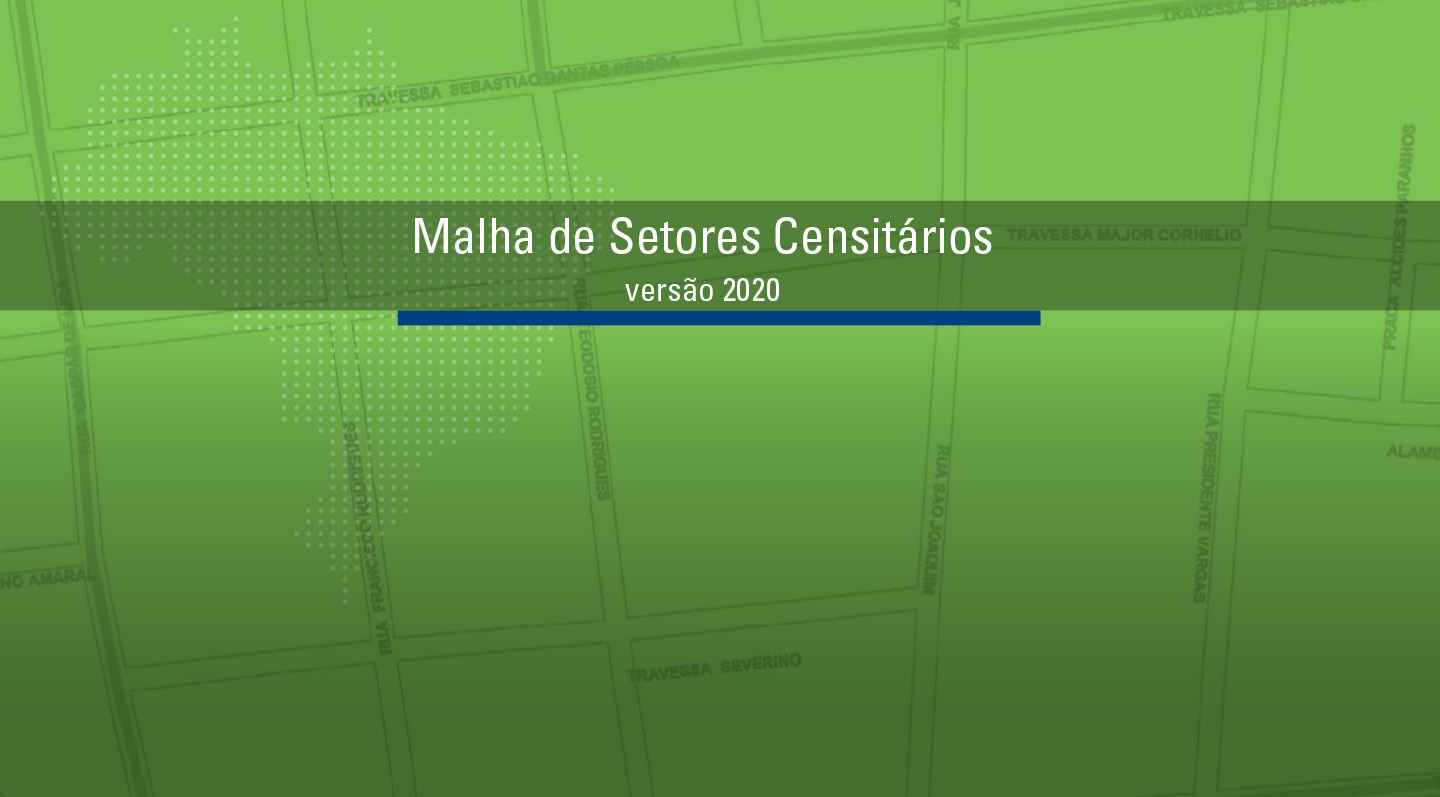
NP-Territorial meshes
- NP-Mesh of Enumeration Areas
Mesh of Enumeration Areas
Description
It is a compilation, in digital format, of the smallest territorial portion used by IBGE to plan and carry out data collection for the Census and Statistical Surveys: the Enumeration Area. This corresponds to a section of the national territory, considering the Political-Administrative Division and other territorial structures, which allows the collection of statistical information within the due collection period.
It depicts the stage of IBGE's cadastral systems in time, according to the processes of data acquisition, treatment, management and updating, to be used in the construction of the Census Mapping for the Population Censuses and Household Surveys. It constitutes an overview of the Brazilian Political-Administrative Division in force on the reference date, including States, Federal District, Municipalities, Districts and Subdistricts, whose cadastral identification comprises the code of the enumeration area. In addition, each enumeration area brings information capable of organizing the collection, such as its urban or rural location/feature and status of locations, such as cities, villages, urban centers and rural agglomerations.
As of 2020, it became possible to distinguish the Mesh of Enumeration Area or, simply Census Mesh, from the new product, the Intermediate Mesh of Enumeration Area. The former is linked to the disclosure of the results of operations such as Population Censuses, Censuses of Agriculture and Population Count. In this case, as it is the result of a thorough survey of the Brazilian territory, it will have a much larger set of information than the Intermediate Mesh of Enumeration Areas. This, in turn, will bring annually updated information on territorial changes that affect the form and classification of enumeration areas on a annual basis, although it does not bring the statistical information brought by the former.
About the publication - 2022 Census Mesh
The Population Census is the major reference for understanding the living conditions of the population in every Brazilian Municipality and internal geographies, providing valuable subsidies for the public administration and for the economic and social planning of Brazil through results in a number of geographies and formats.
The Mesh of Enumeration Areas, one of the forms of dissemination of this operation, includes the territorial units of data collection and dissemination of the population results of the survey.
As a result of technological advances, the 2022 Population Census allowed to implement, for the first time ever, improvements in the Territorial Base and in its classifications, based on data collected before the release of the final aggregate results, which became an opportunity to launch the preliminary Mesh of Enumeration Areas, whose compilation aimed at subsidizing the release of the first aggregates of population and households, thus assuring that such information be available to users as fast as possible.
The Mesh now released reflects the Brazilian political-administrative division on July 31, 2022, reference date of the survey, and takes into account the dynamics of the territorial borders in the scope of the covenants that the IBGE maintains with state offices in charge of such information, based on the legislation then in force on the theme. It subsidizes the dissemination of every result of the 2022 Population Census in relation to the 5,568 Brazilian Municipalities plus the Federal district and the Insular District of Fernando de Noronha, including not only the update of the borders in the official territorial structure informed to the IBGE by state offices in charge of this matter and/or Legislative Assemblies up to July 31, 2022, according to Resolution no. 32, of June 9, 2022, of the IBGE´s Board of Directors, as well as the borderline of Brazil with neighbor countries, provided by the Ministry of Foreign Relations.
In its final version, the 2022 Mesh of Enumeration Areas benefits from the procedures of edit and suitability of these units to the territorial configuration existing on the reference date of the survey, in order to enable the statistical aggregation of a higher amount of variables, and thus replaces the Mesh previously released, which, due to its preliminary nature, shows potential differences concerning the features, borders and/or attributes then represented.
In this edition, the digital geospatial files representing the Enumeration Areas include information on the framing of these territorial units, not only in relation to the current political-administrative division, but also in relation to the geographies mapped by the IBGE, such as Urban Centers, Urban Communities and Favelas, Rural Agglomerates (settlements, centers and villages), Quilombola and Indigenous Groups, among others. The files show details on the status and operational types of the Enumeration Areas, allowing the differentiation of the statistical results, either in terms of the urban or rural status of households or other relevant spatial configurations for the interpretation of the data. For the first time ever, the areas of the Enumeration Areas are informed, separating the portions effectively domiciled, which are identified based on the concentration of the enumerated addresses, allowing the improvement of studies and analyses related to the population density of the territories.
Given the IBGE commitment with the comparability of the statistical data produced, the digital geospatial files of the 2022 Mesh of Enumeration Areas include information that allows the recomposition of the operations of division and aggregation of Enumeration Areas, in order to improve the possibilities to compare such data in more detailed scales.
The technical notes that integrate the publication summarize the general procedures used to produce this Mesh and describe, among other considerations of methodological nature, the organization of the vector files and the geo-codification of the territorial units considered.
This information is available in several access points on the IBGE portal, among them the 2022 Census Overview channel and the page of the survey, which includes multiple aspects of the operation.
More on the product - 2022 Census Mesh
Vector geospatial files
- Map of Enumeration Areas – Brazil (shp | gpkg)
- Map of Enumeration Areas – by FU (shp | gpkg | kml)
- Map of Districts – Brazil (shp | gpkg )
- Map of Districts – by FU (shp | gpkg)
- Map of Subdistricts – Brazil (shp | gpkg )
- Map of Subdistricts – by FU (shp | gpkg)
- Geospatial file of Neighborhood – Brazil (shp | gpkg)
- Geospatial file of Neighborhood – by FU (shp | gpkg)
- Data dictionary (map) ( xlsx | ods)
- Descriptions of boundaries of Emu,eration Areas ( xlsx )
Comparabilidty between Map of Enumeration Areas of the 2010 and 2022 Population Censuses
- Background - formation of Enumeration Areas (2010-2022) (xlsx | ods)
- Read me – Observations about the comparability of Enumeration Areas and the 2010 and 2022 Population Censuses (pdf)
Territorial area effectively inhabited in Anumeration Areas
Publications - 2022 Census Mesh
Malha de setores censitários / IBGE
Material type: Book
Year: 2024
Learn more - 2022 Census Mesh
Setor Censitário
Cada setor censitário possui um sequencial identificador, denominado geocódigo. É formado através da recomposição da organização político-administrativa: os dois primeiros dígitos se referem ao código do Estado; os cinco subsequentes se relacionam ao Município; os dois seguintes indicam o Distrito; os dois na sequência apontam o Subdistrito; os quatro últimos ao Setor Censitário.
| UF | Município | Distrito | Subdistrito | Setor | ||||||||||
|---|---|---|---|---|---|---|---|---|---|---|---|---|---|---|
| 2 | 1 | 0 | 0 | 8 | 7 | 3 | 0 | 5 | 0 | 0 | 0 | 0 | 2 | 6 |
Com o objetivo de viabilizar múltiplas combinações para extração de informações, cada setor censitário também estará devidamente vinculado às Grandes Regiões, às Unidades da Federação, às Regiões Geográficas Intermediárias e Imediatas, às Concentrações Urbanas e aos Municípios, além de suas subdivisões internas, de Distritos, Subdistritos e Bairros.
Campos de atributos dos arquivos vetoriais de Setores Censitários
| Campos conforme formato | Descrição da informação | |
|---|---|---|
| GPKG | SHP | |
| id | - | Código de Identificação da Feição Cartográfica |
| CD_SETOR | CD_SETOR | Geocódigo do Setor Censitário |
| SITUACAO | SITUACAO | Situação do Setor Censitário: |
| Urbana | ||
| Rural | ||
| CD_SITUACAO | CD_SITUACAO | Situação detalhada do Setor Censitário: |
| 1 – Área urbana de alta densidade de edificações de cidade ou vila | ||
| 2 – Área urbana de baixa densidade de edificações de cidade ou vila | ||
| 3 – Núcleo urbano | ||
| 5 – Aglomerado rural - Povoado | ||
| 6 – Aglomerado rural - Núcleo rural | ||
| 7 – Aglomerado rural - Lugarejo | ||
| 8 – Área rural (exclusive aglomerados) | ||
| 9 – Massas de água | ||
| AREA_KM2 | AREA_KM2 | Área calculada em km² do Setor Censitário |
| CD_REGIAO | CD_REGIAO | Código da Grande Região |
| NM_REGIAO | NM_REGIAO | Nome da Grande Região |
| CD_UF | CD_UF | Código da Unidade da Federação |
| NM_UF | NM_UF | Nome da Unidade da Federação |
| CD_MUN | CD_MUN | Código do Município |
| NM_MUN | NM_MUN | Nome do Município |
| CD_DIST | CD_DIST | Código do Distrito |
| NM_DIST | NM_DIST | Nome do Distrito |
| CD_SUBDIST | CD_SUBDIST | Código do Subdistrito |
| NM_SUBDIST | NM_SUBDIST | Nome do Subdistrito |
| CD_BAIRRO | CD_BAIRRO | Código do Bairro |
| NM_BAIRRO | NM_BAIRRO | Nome do Bairro |
| CD_NU | CD_NU | Código de Núcleo Urbano |
| NM_NU | NM_NU | Nome do Núcleo Urbano |
| CD_FCU | CD_FCU | Código da Favela e Comunidade Urbana |
| NM_FCU | NM_FCU | Nome da Favela e Comunidade Urbana |
| CD_AGLOM | CD_AGLOM | Código do Aglomerado |
| NM_ AGLOM | NM_ AGLOM | Nome do Aglomerado |
| CD_RGI | CD_RGI | Código da Região Geográfica Imediata |
| NM_RGI | NM_RGI | Nome da Região Geográfica Imediata |
| CD_RGINT | CD_RGINT | Código da Região Geográfica Intermediária |
| NM_RGINT | NM_RGINT | Nome da Região Geográfica Intermediária |
| CD_CONCURB | CD_CONCURB | Código da Concentração Urbana |
| NM_CONCURB | NM_CONCURB | Nome da Concentração Urbana |
Fonte: IBGE, Malha de Setores Censitários – 2022.
Formatos e organização dos aquivos
O produto “Malha de Setores Censitários preliminares – 2022” compreende arquivos nos seguintes formatos:
- GeoPackage (.gpkg): formato de dados abertos para Sistemas de Informações Geográficas;
- Shapefile (.shp): formato de armazenamento de dados de vetor. É armazenado como um conjunto de arquivos relacionados e contém uma classe de feição;
- Keyhole Markup Language (.kml): formato utilizado para exibir dados geográficos em navegadores terrestres interativos baseado em padrão XML.
Os arquivos estarão disponíveis para todo o País e recortados por Unidades da Federação para os recortes geográficos de Distritos, Subdistritos, Setores Censitários e Bairros.
A seguir, apresentamos a descrição dos atributos conforme os formatos adotados e a definição do conteúdo.
Os arquivos vetoriais englobam os 468 097 Setores Censitários, adicionados de suas áreas estaduais operacionais referentes à Lagoa dos Patos e à Lagoa Mirim, ambas atribuídas ao Rio Grande do Sul.
Quantitativos
Unidades territoriais de Setores Censitários, Municípios, Distritos e Subdistritos por Grande Regiões e Unidades da Federação - 2022
| Recorte territorial | Unidades territoriais | ||||
|---|---|---|---|---|---|
| Setores censitários (1) | Municípios (2) | Distritos (3) | Subdistritos | Bairros | |
| Brasil | 468 097 | 5 570 | 10 698 | 643 | 17 575 |
| Norte | 40 506 | 450 | 700 | 14 | 1 417 |
| Rondônia | 3 456 | 52 | 105 | 5 | 355 |
| Acre | 2 215 | 22 | 26 | - | 83 |
| Amazonas | 10 729 | 62 | 103 | 9 | 469 |
| Roraima | 1 783 | 15 | 15 | - | 55 |
| Pará | 16 714 | 144 | 260 | - | 362 |
| Amapá | 1 492 | 16 | 34 | - | 93 |
| Tocantins | 4 117 | 139 | 157 | - | - |
| Nordeste | 122 622 | 1 794 | 3 321 | 71 | 3 830 |
| Maranhão | 16 301 | 217 | 243 | - | 173 |
| Piauí | 7 340 | 224 | 224 | 5 | 479 |
| Ceará | 20 979 | 184 | 894 | 12 | 1 311 |
| Rio Grande do Norte | 6 095 | 167 | 191 | 4 | 185 |
| Paraíba | 9 639 | 223 | 297 | - | 257 |
| Pernambuco | 19 578 | 185 | 404 | 15 | 660 |
| Alagoas | 6 359 | 102 | 116 | 8 | 125 |
| Sergipe | 5 346 | 75 | 98 | - | 185 |
| Bahia | 30 985 | 417 | 854 | 27 | 455 |
| Sudeste | 205 112 | 1 668 | 3 437 | 221 | 6 427 |
| Minas Gerais | 51 387 | 853 | 1 817 | 101 | 1 994 |
| Espírito Santo | 8 706 | 78 | 278 | 20 | 754 |
| Rio de Janeiro | 41 700 | 92 | 300 | 100 | 1 509 |
| São Paulo | 103 319 | 645 | 1 042 | - | 2 170 |
| Sul | 66 080 | 1 191 | 2 487 | 223 | 4 938 |
| Paraná | 23 777 | 399 | 765 | 67 | 966 |
| Santa Catarina | 16 736 | 295 | 468 | - | 1 732 |
| Rio Grande do Sul | 25 567 | 497 | 1 254 | 156 | 2 240 |
| Centro-Oeste | 33 777 | 467 | 753 | 114 | 963 |
| Mato Grosso do Sul | 6 117 | 79 | 164 | 12 | 296 |
| Mato Grosso | 9 381 | 141 | 261 | 6 | 635 |
| Goiás | 12 861 | 246 | 327 | 63 | 32 |
| Distrito Federal | 5 418 | 1 | 1 | 33 | - |
Fonte: IBGE, Malha de Setores Censitários 2022.
(1) Nos arquivos vetoriais de Setores Censitários, constam áreas operacionais referentes à Lagoa dos Patos e à Lagoa Mirim.
(2) Nos arquivos vetoriais de Municípios, Brasília, capital federal e sede do Distrito Federal, e o Distrito Estadual de Fernando de Noronha, por razões cadastrais, são armazenados como Municípios. Constam ainda áreas operacionais referentes à Lagoa dos Patos e à Lagoa Mirim.
(3) Nos arquivos vetoriais de Distritos, consta uma área operacional referente à Lagoa dos Patos e à Lagoa Mirim.
Observações técnicas
- A Malha Censitária disponibilizada é compatível com escalas de 1:5.000 a 1:250.000, sem supressão de pontos, de acordo com critérios técnicos preestabelecidos pela IBGE/DGC/CETE;
- Sistema Geodésico de Referência: SIRGAS 2000;
- Sistema de Coordenadas Geográficas;
- Codificação de texto: UTF-8.
Isenção de Responsabilidade
O IBGE alerta que é recomendável a leitura da documentação técnica, disponível em todas as versões da Malha Municipal e da Malha de Setores Censitários antes da utilização dos produtos para minimizar as dúvidas e evitar o mau uso das informações. Destaca-se que a ampliação da escala da Malha descaracteriza e introduz distorções no produto disponibilizado.
A Malha de Setores Censitários exprime o esforço do IBGE em representar geometricamente um cenário que abrange a visão instantânea e aproximada da realidade em que a precisão das linhas depende de diversos fatores, tais como da completude e da atualização da legislação, dos tipos de feições, da qualidade gráfica e da atualização da cartografia disponível ou da resolução das imagens orbitais e ortofotos utilizadas.
Devido à esta particularidade, é necessário destacar que:
- O IBGE não se responsabiliza por definir a posse de qualquer ilha localizada em rios, lagoas, lagos, baías, estuários ou no oceano, que não esteja definida a sua subordinação político-administrativa na legislação, obedecendo a critérios hierárquicos no nível federal e estadual;
- O IBGE não se responsabiliza por definir a posse ou a subordinação político-administrativa de imóvel urbano ou rural, linhas de dutos, usinas, aeroportos, antenas, poços de petróleo ou gás, áreas de mineração, torres de parques eólicos, praças de pedágio, posto fiscal e qualquer outra edificação ou instalação comercial ou industrial.
O IBGE agradece a comunicação de quaisquer discordâncias com relação à malha de setores alertando os usuários que o referido produto não pode ser objeto de certidões e nem têm eficácia jurídica como prova ao assumirem para si, qualquer responsabilidade sobre o uso desta malha para finalidades outras, estando o IBGE isento de qualquer responsabilidade advindos de eventuais maus usos.
News and Releases
IBGE launches Intermediate Sectoral Mesh 2021
The IBGE releases today (21) the Intermediate Sectoral Mesh 2021 in digital format, including the classification...
21/11/2022
IBGE discloses the 2020 Intermediate Mesh of Enumeration Areas
Today (25) the IBGE publishes the 2020 Intermediate Mesh of Enumeration Areas in digital format, with...
25/02/2021
IBGE launches Intermediate Sectoral Mesh 2019
The IBGE releases today (30) the Intermediate Sectoral Mesh 2019 in digital format, including the classification...
30/07/2020

Errata
Amendment in the release of the 2020 Intermediate Mesh of Enumeration Areas
Published date: 15/03/2021
Description:
Amendment in the release of the 2020 Intermediate Mesh of Enumeration Areas, published on February 25, after determining inconsistencies in the counting of enumeration areas, which were amended from 448,988 to 449,880.
Files in shape and kml format of the "2020 Intermediate Sectoral Mesh" were replaced to correct the field “Sub-district” in the Federal District and the field “District” in the Muncipalities of 2205706 - Luís Correia-PI; 2401305 - Campo Grande-RN; 2601607 - Belém do São Francisco-PE; 3122900 - Dona Euzébia-MG; 4216057 - São Cristóvão do Sul-SC; 4323770 – Westfália-RS; 5000203 - Água Clara-MS; 5001904 – Bataguassu-MS and 5220157 - São Luiz do Norte-GO.Actions: The news was updated at https://agenciadenoticias.ibge.gov.br/en/agencia-press-room/2185-news-agency/releases-en/30121-ibge-divulga-malha-setorial-intermediaria-2021.
The files were replaced at https://www.ibge.gov.br/en/geosciences/territorial-organization/territorial-organization/28114-malhas-de-setores-censitarios-divisoes-intramunicipais-2.html?=&t=o-que-e.
Links