

Nossos serviços estão apresentando instabilidade no momento. Algumas informações podem não estar disponíveis.
-
Home

-
Geosciences
-
Environmental Information
-
Pedology
- NP-Novo Portal
Environmental Information Database | BDiA - web (en)
Technical Information
Methodology
Methodological note: Version 2023 - Mapping of Natural Resources (MRN) Scale 1:250 000
About the publication - BDiA - web (en)
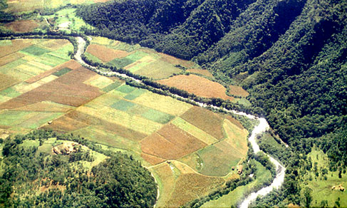
The Environmental Information Database (BDiA) is a system of environmental information for Brazil, publicly available on the web, that gathers the whole set of thematic bases of the mapping of natural resources in Brazil in the Geology, Geomorphology, Pedology and Vegetation themes, produced by the IBGE along the last two decades. This platform aims at sharing this collection of geo-spatial information, in a multi-scale and inter-thematic format, so as users get to know the environmental characteristics of the Brazilian territory.
The databases included in the BDiA, compatible with the 1:250,000 scale, were developed under the scope of SIVAM and Natural Resources Mapping projects from 1998 onwards. The methodologies and procedures used to develop these databases are an evolution of the methods developed along the RADAM/RADAMBRASIL Project, which surveyed the Brazilian non-marine natural resources in the 1:1,000,000 scale in the 1970s and 1980s. In the BDiA, users are able to browse through different themes, viewing their delimitations, classifications and statistics, as well as to carry out spatial queries by state, municipality, biome and mapping unit and to export the spatial analyses, either in graphic (mapping) or numeric terms (tabular) from a number of territorial divisions.
The platform includes an experimental module that allows to query and match environmental information in the Statistical Grid, which encompasses, beyond the thematic mapping already mentioned, the geo-spatial data of the Monitoring of Land Use and Cover and other integrated environmental studies, as well as to download the information in several formats.
The data in this information system is updated every two years, based on constant revisions in the thematic mappings of natural resources, as well as on the incorporation of new environmental geo-spatial products.
More on the product - BDiA - web (en)
BDiAWeb
The BDiAWeb portal is a platform to consult BDiA data aiming at interactively sharing the IBGE´s environmental information. In this first version, each theme presents 3 levels of caption, according to the visualization scale within the platform. The first two levels of caption were "rasterized" to improve the performance of the data browsing; on the other hand, the third level maintains the original vector format and the data can be accessed by clicking in each polygon. The 3 levels of caption are described in the information menu of each theme, as well as the additional layers belonging to each one.
New features will be constantly implemented and the data will be updated on a 2-year basis As of April 2019, the consultations made in the platform will be able to be exported.
The consultation in statistical grid, which allows to cross the data in the first two levels of caption of each theme, is in the test phase.
Learn more - BDiA - web (en)
News and Releases
Event will discuss project Radam's effects in the South Region of the country
The IBGE and the Santa Catarina State University are preparing the 7th IBGE Memory Panel: Radam/Radam...
18/04/2019
Errata
Calendar error in release "BDiA - Environmental Information Database"
Published date: 23/10/2025
Description:
Error characterized for not meeting the scheduled release date of the product, according to calendar disclosed in December 2024. The product has been postponed due to the need to readjust the deadlines during the internal steps of its production. Therefore, the release of the product "BDiA - Environmental Information Database" has been transferred from November to December 2025.Actions: The release calendar has been changed.