

Nossos serviços estão apresentando instabilidade no momento. Algumas informações podem não estar disponíveis.
-
Home

-
Geosciences
-
Territorial organization
-
Geographic networks and flows
- NP-Air Links
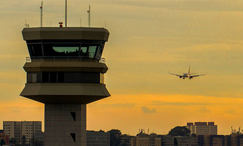
Air Links
Description
The study of Air Links identifies the flows of passenger and cargo air transportation, aiming at characterizing the location of Brazilian cities in the national urban system, taking this transportation mode as a base, and at evaluating its accessibility from the perspective of the financial costs and commuting time.
About the publication - 2019-2020
The Project Territory Flows and Networks constitutes a line of inquiry intended to analyze the relationships and links between Brazilian cities, as well as their accessibility and the spatial configuration of exchanges between them, of either material (persons, goods, cargo) or immaterial nature (information, money, management).
With this publication, the IBGE presents the results of its latest survey about the topic, which encompasses, similarly to the previous one, flows derived from air transportation, aiming not only at describing the position of Brazilian cities in the national urban system considering this mode, but also evaluating its accessibility from the perspective of fare costs, options of passengers flown and the duration of trips departing from airports, besides characterizing the access by passengers that need to move from other cities that do not provide regular air transportation services.
In this edition, it is worth pointing out that, due to the COVID 19 pandemic, our choice was to approach the relationships between Brazilian cities with regard to air transportation under “normal” operational conditions, by making use of data of 2019 and, also, indicating, even in a preliminary way, the impacts of the pandemic on the sector based on data of 2020. In this respect, three principal bases were used. The first one gathers information from the National Aviation Agency – ANAC, whose records have allowed the characterization of passenger and cargo movement and provided subsidies for the analysis of accessibility of cities considering data about direct flights from each airport. The second one, also by ANAC, presents the microdata of airfares traded, which make it possible to characterize the accessibility of cities with airports and define a geographic patters of interactions between them, having as a reference the place of departure and the destination of trips. The third base, of the Secretariat of Aviation in partnership with the Laboratory of Transportation and Logistics of the Federal University of Santa Catarina – UFSC, results from the combination of official data of cell phone movements registered by mobile transmission towers, thus generating an origin-destination matrix of all those that moved to access an airport and of the number of persons doing it. That has made possible the characterization of this access by passengers from other cities, having, additionally, a regional profile of those cities with an airport.
Given the relationship o fair lows with the urban network, this group of information, besides allowing the analysis of an important aspect of the Brazilian reality, also provides inputs for the coming edition of the survey Area of Influence of Cities – Regic – as it reflects how the urban network is structured and how links between cities operate.
Publications - 2019-2020
Ligações aéreas : 2019-2020 / IBGE, Coordenação de Geografia
Material type: Book
Year: 2021
Learn more - 2019-2020
Downloads
News and Releases
Study shows status of the aviation sector in Brazil and impacts of Covid-19
The impact of the Covid-19 panemic on the natioal aviation sector in 2020 led to the decrease of 53%...
10/12/2021
FAQ
What is the Air Links study?
The study Air Links identifies the air transportation flows of passenger and cargo, aiming at characterizing the location of Brazilian cities in the national urban system, taking this transportation mode as a basis, and at evaluating its accessibility from the perspective of financial costs and commuting time.
Your question was not answered here?
Please contact us through our service channels.